When I studied archaeology, it was a very different topic. We learnt about cultural change through the examination of specific artefact and monument types, often assuming that the pieces that we found were finished and perfect.
When I studied archaeology, it was a very different topic. We learnt about cultural change through the examination of specific artefact and monument types, often assuming that the pieces that we found were finished and perfect.
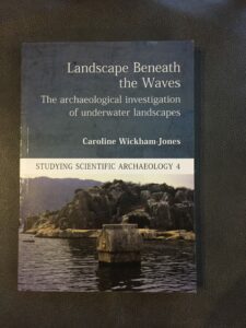
Yesterday I finally received a copy of my new book from the publisher. It is always a process that brings out mixed emotions. Partly I am so fed up with going through the text and illustrations that I can barely bring myself to open it. Partly, Continue reading New Book: Landscape Beneath the Waves
_A2.jpg)
Reconstruction of the face of Cheddar Man: Channel 4.
One of the reasons I love archaeology is the way in which it challenges us to recognise and rethink our preconceptions. It is very easy to live in the cosy world of today and focus on reassuring feelings of stability. Practices of mindfulness, among others, encourage us to ‘live for the moment’ and, amidst the insecurites of the present, this is not something with which I would wish to disagree. Continue reading The challenging of preconceptions
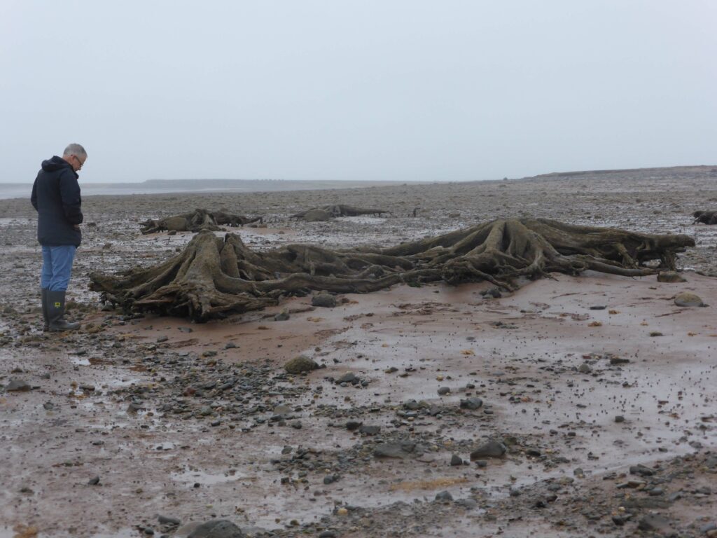
If you travel to Shetland today you will find a rather beautiful island chain that essentially comprises a series of steep hills. The topography is abrupt and dramatic; the landscape is gentler towards the coast, but in most places Continue reading The northern reaches of Doggerland
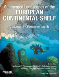
A new book summarizes the Quaternary environments of the submerged landscapes of the European continental shelf. It is a detailed overview that extends from the Baltic to the Black Sea, and includes some general chapters on Continue reading New publication
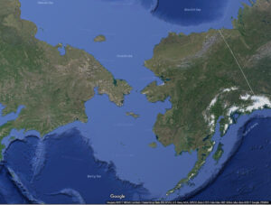
I’ve been doing some research for a book I’m writing. I need to discuss various examples of submerged landscapes around the world. Of course, the first I have picked are my favourites, the closest to home: Doggerland, together with another favourite: Beringia.
Beringia unifies the continents of Asia and North America. It comprises an area of land and water, lying between the Mackenzie River in Canada and the Lena River in Russia and extending from the northern coastlands to the southern tip of Kamchatka. It takes its name from the narrow Bering Straits, named after the eighteenth century Danish navigator Vitus Bering (he was actually working for the Russian Czar, Peter the Great). The archaeology of Beringia includes the terrestrial sites on either side of the straits, as well as the submerged landscape.
Doggerland lies between Britain and the Continent. Its full extent and coastline are still known only through modelling, and interpretations of the data vary, but at the height of the last glaciation it is likely to have extended to the north of Shetland, only to disappear slowly as a result of sea-level rise and crustal readjustment in the millennia following deglaciation. Doggerland was no mere landbridge, recent research is investigating the topography, flora and fauna of the ancient land surfaces below the current sea bed.
Beringia is a significant location for the study of submerged landscapes, not least because of the way in which the terrestrial and underwater archaeology are regarded as part of a unified whole. This approach has, largely, yet to be achieved in studies closer to home; for example, research on Doggerland still focuses on a submerged landscape that is defined by the present-day UK and European coastlines to either side of it. When you think about it, this is a strange concept for archaeology because the whole point about Doggerland (and indeed any submerged landscape) is that the current coastlines did not exist when it was dry land and inhabited.
While, research about Doggerland is expressed as underwater investigations of a submerged landscape that operated in conjunction with the adjoining land masses, the focus for the archaeology of Beringia is different. It encompasses an environmental and cultural landscape that stretches across both dry and inundated terrain as a seamless whole. There are, of course, terrestrial and underwater elements to this research, depending on where it is based, but, in general, this produces a more holistic view. It allows us to put the archaeology into its proper context.
This may seem like pedantry, but it is more significant than that. The work we do, and the narratives that we draw from it, are influenced by the pictures that we have in our minds eye and as long as we see the archaeology of submerged landscapes as separate to that of the land, then we will treat them differently.
This is important for two reasons, one to do with the past and one to do with the present. In general, the submerged landscapes around the world were last available for human activity from the millennia around the height of the last glaciation into the earliest millennia of the Holocene. This coincides with the time when modern humans were, in many cases, expanding their territories into new and unexplored lands. In several cases this expansion made use of lands that are now submerged, though access to any archaeological information has, until recently, been restricted by the depths of water that now cover them. Both Beringia and Doggerland are implicated in human expansions: in the case of Beringia the movement of peoples from Asia into North America and in the case of Doggerland, the exploration of northern Britain in the Late Upper Palaeolithic and the subsequent expansion of microlith-using Mesolithic communities in the Early Holocene. All of these episodes are crucial for our understanding of the creation of the modern world. But, in order to understand them fully, we need to focus on more than the underwater portion of the trip as this is a mere accident of history, no more than a taphonomic process.
All archaeologists today, therefore, whatever their chosen specialisations, require a basic grounding in the archaeology of submerged landscapes. It should be an automatic inclusion in any university course, as essential as radiocarbon dating, artefact analysis, or the Neolithic; as obvious as upland archaeology, the preservation conditions of peat, or the contribution of pollen analysis. The archaeology of submerged landscapes is not an add-on, but I fear that, for the most part, we still treat it as such. Hopefully, with time, the holistic philosophy of Beringia will permeate our mindsets.
You must be logged in to post a comment.